
History of Information Graphics (Multilingual Edition) 29804
In the age of big data and digital distribution, when news travel ever further and faster and media outlets compete for a fleeting slice of online attention, information graphics have swept center stage. At once nuanced and neat, they distill abstract ideas, complex statistics, and cutting-edge discoveries into succinct, compelling, and masterful designs. Cartographers, programmers, statisticians, designers, scientists, and journalists have developed a new field of expertise in visualizing knowledge.
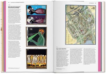
This XL-sized compendium explores the history of data graphics from the Middle Ages right through to the digital era. Curated by Sandra Rendgen, some 400 milestones span astronomy, cartography, zoology, technology, and beyond. Across medieval manuscripts and parchment rolls, elaborate maps, splendid popular atlasses, and early computer-based information design, we systematically break down each work’s historical context, including such highlights as Martin Waldseemuller’s famous world map, the meticulous nature studies of Ernst Haeckel, and many unknown treasures.
Hot on the heels of the best-selling Information Graphics and Understanding the World, this third volume fills the gap as an unprecedented reference book for data freaks, designers, historians, and anyone thirsty for knowledge. An enthralling exploration into the teachings, research, and lives of generations past.
В епоху великих даних і цифрової дистрибуції, коли новини поширюються все швидше і швидше, а медіа змагаються за миттєвий шматочок уваги в Інтернеті, інформаційна графіка вийшла на перший план. Водночас нюансована й акуратна, вона перетворює абстрактні ідеї, складну статистику та найсучасніші відкриття на лаконічні, переконливі та майстерні дизайни. Картографи, програмісти, статистики, дизайнери, науковці та журналісти створили нову галузь знань у візуалізації знань.
Цей збірник XL-розміру досліджує історію графіки даних від Середньовіччя до цифрової ери. Під кураторством Сандри Рендген, близько 400 віх охоплюють астрономію, картографію, зоологію, технології та інші галузі. Від середньовічних манускриптів і пергаментних сувоїв, складних карт, розкішних популярних атласів і ранніх комп'ютерних інформаційних проектів ми систематично розглядаємо історичний контекст кожної роботи, включаючи такі пам'ятки, як знаменита карта світу Мартіна Вальдзімюллера, ретельні дослідження природи Ернста Геккеля та багато невідомих скарбів.
Цей третій том, що вийшов одразу після бестселерів "Інформаційна графіка" та "Розуміння світу", заповнює прогалину як безпрецедентний довідник для інформаційних фріків, дизайнерів, істориків та всіх спраглих до знань. Захоплююча розвідка про вчення, дослідження та життя минулих поколінь.
- АвторSandra Rendgen
- КатегоріяКультура та мистецтво
- МоваАнглійська
- Рік2019
- Сторінок462
- Формат250х380 мм
- ОбкладинкаТверда
- Тип паперуКрейдований
- ІлюстраціїКольорові
4460 ₴
Відділення Нова Пошта80 ₴
Поштомат Нова Пошта80 ₴
Кур’єр Нова Пошта120 ₴
Відділення УкрПошта50 ₴
Кур’єр за адресою90 ₴


допоможіть тим, хто ще не читав